
Visualisation and Download Services
Explore the geospatial services provided by LNEG for viewing, querying and downloading data and maps. The URLs for WMTS, WMS, WFS and OGC API services can be used in compatible applications, facilitating access to and reuse of geoscientific information.
Areas of Prospection and Exploration Allocated to Mining Companies (1955-2003)

Aspect Map of Mainland Portugal (EU DEM)

Atlas of Wind Potential of Continental Portugal
Biomass Potential for Energy - CONVERTE
Biomethane Atlas for Mainland Portugal

Borehole Database - SONDABASE
Clay Resource Map of the Western Rim and Inland Basins
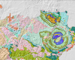
Critical Raw Materials Deposits in Mainland Portugal
Data Source - Geothermal Atlas
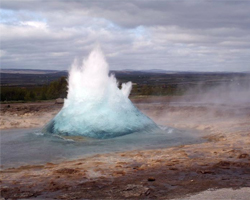
Database of the Museum of Portuguese Mineral Deposits
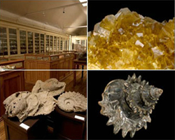
Geologic Map of the Marbles from Viana do Alentejo-Alvito, Portugal
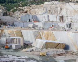
Geological and Hazard Cartography, scale 1:3000
Geological Map of Portugal, scale 1:1 000 000
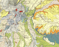
Geological Map of Portugal, scale 1:200 000
Geological Map of Portugal, scale 1:50 000
Geological Map of Portugal, scale 1:500 000
Geological Map of Schist Resources of Pedreira do Mestre André (Barrancos), scale 1:2 500
Geological Map of Spain and Portugal, scale 1:1 000 000
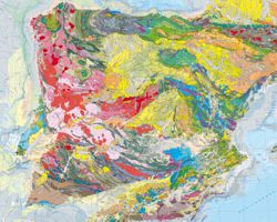
Geological Map of the Algarve Region, scale 1:100 000
Geological Map of the Arouca Geopark, scale 1:50 000
Geological Map of the Brecha Algarvia Ornamental Limestone, scale 1:5 000
Geological Map of the Douro Demarcated Region, scale 1:25 000
Geological Map of the Estremoz Anticline, scale 1:25 000
Geological Map of the Municipality of Lisbon, scale 1:10 000
Geological Map of the Noudar Nature Park (Herdade da Coitadinha-Barrancos), scale 1:10 000
Geological Map of the Republic of Guinea-Bissau, scale 1:400 000
Geological Map of the South Portuguese Zone, scale 1:400 000 - GEO_FPI Project
Geological Map Transfrontier Zone of Spain and Portugal - South Portuguese Zone, scale 1:200 000 - GEO_FPI Project
Geological Maps of the Autonomous Region of Azores
Geological Maps of the Autonomous Region of Madeira
Geology of the Marble Exploitation Centers in the Estremoz Anticline (2003-2008)
Geoscientific Photographs - GEOPHOTOS
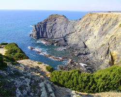
Geothermal Atlas of Continental Portugal
Geothermal Gradient Map (°C/km) – Geothermal Atlas
Gravimetric Map (Bouguer Anomaly), scale 1:400 000 - Explora Project
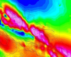
Gravity Anomaly of the Portuguese Sector of the Iberian Pyrite Belt
Grid Connections and Electric Consumption - OffshorePlan Project

Harmonised Geological Map Data of Portugal, scale 1:1 000 000

Harmonised Geological Map Data of Portugal, scale 1:200 000
Harmonised Geological Map Data of Portugal, scale 1:50 000
Harmonised Geological Map Data of Spain and Portugal, scale 1:1 000 000
Harmonised Geological Map Data of the Algarve Region, scale 1:100 000
Heat Flow Density Map (mW/m²) – Geothermal Atlas
Heat Flow Density Zoning Map – Geothermal Atlas
Horizontal Wind Speed Atlas h=100m - OffshorePlan Project
Hydrogeological Map of Portugal, scale 1:200 000
Hydrogeological Map of Portugal, scale 1:200 000 - Vector
Hydrogeological Resources Database
Images of Unmanned Aircraft Systems Data (UAS/Drones)
Integrated Infrastructure for CO₂ Transport and Storage in the West Mediterranean - Comet

Inventory of Sites with Geological Interest
Less sensitive areas with a view to the potential installation of solar and wind electricity generation units (version June 2023)
Magnetic Anomaly of Southern Portugal
Map of Mineral Deposits of the Northern Region of Portugal, scale 1:200 000
Map of Temperatures at 1000 m Depth - Geothermal Atlas
Map of Temperatures at 2000 m Depth - Geothermal Atlas
Map of Temperatures at 250 m Depth - Geothermal Atlas
Map of Temperatures at 500 m Depth - Geothermal Atlas
Map of Temperatures at 5000 m Depth - Geothermal Atlas
Map of the Number of Hours at Full Capacity [NEPS] of Portugal’s Wind Resource
Map of the Reduced Magnetic Field to the Pole of the Neves-Corvo Region, scale 1:50 000 - Explora Project
Map of the Superficial Volumetric Thermal Capacity of Mainland Portugal, scale 1:500 000 – Geothermal Atlas
Maps of Mineral Deposits of Portugal in the range of 1:200 000
Metallogenic Map of the South Portuguese Zone, scale 1:400 000 - GEO_FPI Project
Mineral Occurrences Map of Continental Portugal, scale 1:500 000
Mineralogical Indexes of Mainland Portugal
Multivariate Analysis of Sentinel-2 Sensors
Natural Hydrogen Prospectivity Atlas

The atlas presents the first natural hydrogen prospectivity maps for mainland Portugal. Through a probabilistic approach that integrates geological, geophysical, and geochemical data, the study assesses the generation, retention, and presence of subsurface reservoirs for this gas. The goal is to identify the most promising areas for future exploration campaigns, driving a sustainable energy transition.
Natural Hydrogen Prospectivity Atlas: Aggregate Contribution of Sealing Map - COS P50 RS
Characterisation of the aggregated contribution of geological sealing conditions to natural hydrogen accumulation and preservation in mainland Portugal, based on the P50 estimate.
Natural Hydrogen Prospectivity Atlas: Aggregate Source Contribution Map - COS P50 SL Total
Map showing the aggregated contribution of geological factors associated with natural hydrogen generation in mainland Portugal, based on the median P50 estimate.
Natural Hydrogen Prospectivity Atlas: Aggregate Contribution of the Reservoir Map - COS P50 RS Total
Map assessing the aggregated contribution of geological reservoir conditions to natural hydrogen prospectivity in mainland Portugal, based on the median P50 estimate.
Natural Hydrogen Prospectivity Index Map (NH₂PI) P10 estimate
Identification of potentially favourable areas for natural hydrogen occurrence in mainland Portugal, based on the P10 estimate, associated with a more optimistic scenario.
Natural Hydrogen Prospectivity Index Map (NH₂PI) P50 estimate
Map showing natural hydrogen prospectivity in mainland Portugal, based on the median P50 estimate and integrating geological factors relevant to its occurrence.
Natural Hydrogen Prospectivity Index Map (NH₂PI) P90 estimate
Map showing the spatial distribution of natural hydrogen prospectivity in mainland Portugal, based on the P90 estimate, associated with a more conservative scenario.
NEPs - Fixed Jacket System - OffshorePlan Project
NEPs - Monopile System - OffshorePlan Project
NEPs - WindFloat System - OffshorePlan Project
Number of Hours at Full Capacity (NEPs) - OffshorePlan Project
Offshore Minerals Map of Portugal - 2021 Edition
Offshore Wind Incident Power Flux Map (h=100m) - OffShorePlan Project
Onshore Map of Wind Potential of Portugal - Average Speed h=20m (Pixel 500x500m)
Onshore Map of Wind Potential of Portugal - Average Speed h=80m (Pixel 500x500m)
Onshore Map of Wind Potential of Portugal - Incident Power Flow h=20m (Pixel 500x500m)
Onshore Map of Wind Potential of Portugal - Incident Power Flow h=80m (Pixel 500x500m)
Onshore Map of Wind Potential of Portugal - NEPS h=100m (Pixel 500x500m)
Onshore Map of Wind Potential of Portugal - NEPS h=80m (Pixel 500x500m)
Onshore Map of Wind Potential of Portugal - Weibull Form Factor h=20m (Pixel 500x500m)
Onshore Map of Wind Potential of Portugal - Weibull Form Factor h=80m (Pixel 500x500m)
Onshore Map of Wind Potential of Portugal - Weibull Scale Factor h=20m (Pixel 500x500m)
Onshore Map of Wind Potential of Portugal - Weibull Scale Factor h=80m (Pixel 500x500m)
Planning the Instalation of Offshore Renewable Energy systems in Portugal - OffshorePlan Project
Portuguese Atlas of Sustainable Green H₂
Portuguese Corrosion Map (1990-1993)
Portuguese Geothermal Resources Catalog
Portuguese Mineral Resources - SIORMINP
Portuguese Mining Concessions Map (1836-1992)
Portuguese Natural Stones Portal - ROP
Portuguese Thermal Occurrences - TERMALBASE
Potencial Renewable Energy Acceleration Areas (PRAAs)
Potential Areas of Mineral Resources in Portugal
Potentially Favourable Areas for Geological CO₂ Storage in Portugal
Quaternary Active Faults of Iberia
Radiometric Map of Mainland Portugal (2013)
Rocks and Industrial Minerals Map of the South Portuguese Zone, scale 1:400 000 - GEO_FPI Project
Seamless Geology of Portugal at scale 1:200 000 with a Unified Legend - Prototype
Simplified Geological Map of Serra da Estrela Natural Park, scale 1:75 000
Simplified Geological Map of the Islands of Madeira and Porto Santo, scale 1:80 000
Simplified Geological Map of the Municipality of Góis
Slope Map of Mainland Portugal (EU DEM)
Thermal Conductivity Map of Mainland Portugal, scale 1:500 000 scale – Geothermal Atlas
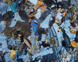
Thin Sections and Polished Surfaces Archive – LAMINOTECA
Waves Bottom-Fixed Oscillating Flap Converter - OffshorePlan Project

Waves Energy Resource - OffshorePlan Project
Waves Floating Oscillation Water Column Converter - OffshorePlan Project
Waves Floating Two-Body Heaving Converter - OffshorePlan Project
Wind Power Density Atlas - OffshorePlan Project
No results found