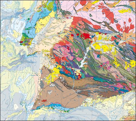
Geological Map of Spain and Portugal, scale 1:1 000 000
The Geological Map of Spain and Portugal at a scale of 1:1 000 000 is the updated version of the geological cartography of the Iberian Peninsula as well as Ceuta and Melilla and the entire island territory of Spain and Portugal: Balearic Islands, Canary Islands, Azores and Madeira. This version includes for the first time the geological cartography of the continental shelf of both countries and of the Atlantic islands.
Geological Map of Spain and Portugal, scale 1:1 000 000
Year:
2015
Edition of Cartography:
1st. Edition
Authors:
Geology, Hydrogeology and Coastal Geology Unit of National Laboratory of Energy and Geology
Email:
cartografia@lneg.pt
Metadata:
Link to metadata