×
Home Page
Metadata
Online Databases
Open Data
Map Viewer
Map Viewer 2D
Map Viewer 3D
Map Viewer Earth Observation
Products List
English
português
English
English
português
English
Back
Back
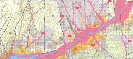
Hydrogeological Map of the Algarve Coast
Hydrogeological Map of the Algarve Coast, on a scale of 1:100 000.
Image of Sheet A1 - Aquifer Systems (JPG)
Image of Sheet A2 - Aquifer Systems (JPG)
Image of Sheet B1 - Vulnerability of Aquifer Systems (JPG)
Image of Sheet B2 - Vulnerability of Aquifer Systems (JPG)
Image of Sheet C1 - Spot Hydrochemistry (JPG)
Image of Sheet C2 - Spot Hydrochemistry (JPG)
Explanatory Notes (PDF)
Hydrogeological Map of the Algarve Coast
Year:
1983
Edition of Cartography:
1st edition
Authors:
Unit of Geology, Hydrogeology and Coastal Geology of LNEG
Email:
aguassubterraneas.ughgc@lneg.pt
Metadata:
Link to metadata
Order:
Link to order
We are using cookies to give you the best experience on our website.
Know our
Cookie Policy
.
Accept