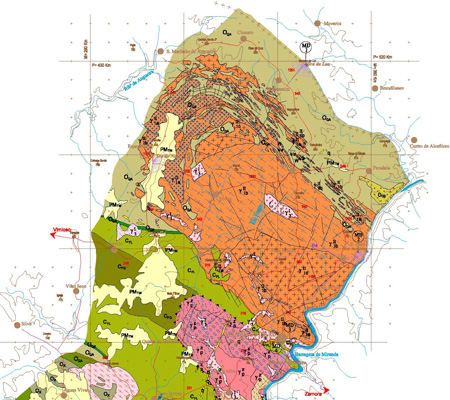
Geological Cartography of the Douro International Natural Park
The Geological Map of the Douro International Natural Park was produced by the National Institute of Engineering, Technology and Innovation and the Earth Sciences Center of the University of Minho, in 2005, and its main objective was to support the lithogeochemical characterization of the Formations of the Douro Group. Douro, from the Douro Demarcated Region.
Geological Cartography of the Douro International Natural Park
Year:
2005
Edition of Cartography:
1st. Edition
Authors:
Departamento de Geologia do INETI and Centro de Ciências da Terra da Universidade do Minho
Email:
cartografia@lneg.pt
Metadata:
Link to metadata